Heavy Rain and Strong Winds Impact South Korea’s Gangwon Mountains
- account_circle Tyo Murty
- calendar_month Saturday, 20 Jun 2026
- visibility 8
- comment 0 comment
- print Print

info Adjust the font size of this article to get the best reading experience.
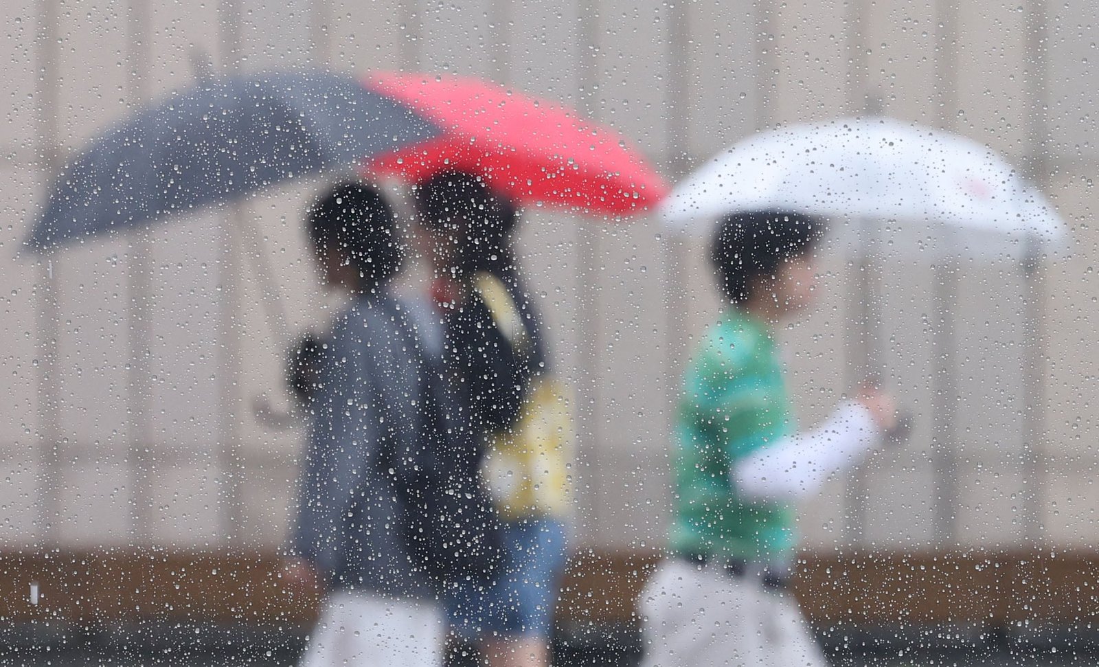
On Saturday, the 20th, rain fell across most regions of the country, accompanied by strong winds, necessitating caution for facility management and preventing safety accidents. While the rain is expected to subside in many areas during the afternoon, it will persist until late at night in the capital region, central regions, and central and northern parts of North Gyeongsang Province, and until the morning of the 21st in the mountainous areas of Gangwon Province and the East Sea coast.
The Korea Meteorological Administration (KMA) forecasted that rain would continue until the evening across the country, which was mostly cloudy on the day. As of now, heavy rain advisories are in effect for the mountainous areas of Gangwon Province, Gongju and Cheongyang in South Chungcheong Province, and Sangju, Yeongju, Yeongdeok, and Uljin plains in North Gyeongsang Province.
The expected precipitation amounts are 30–80 mm in the capital region, 50–120 mm (over 200 mm in some northern mountainous areas) in the mountainous regions and East Sea coast of Gangwon Province, 30–80 mm in inland Gangwon, 20–60 mm in the Chungcheong region, 20–60 mm in North Jeolla Province, 5–40 mm in Gwangju and South Jeolla Province, 30–80 mm in Daegu, North Gyeongsang Province, Ulleungdo, and Dokdo, 20–60 mm (over 80 mm near Jirisan Mountain in some areas) in Busan, Ulsan, and South Gyeongsang Province, 5–40 mm in the Five Western Islands, and 5–40 mm (over 80 mm in some midland and mountainous areas) in Jeju Island.
In areas where rain is falling, sudden gusts of wind and thunderstorms may occur. Caution is needed regarding safety accidents and facility management due to concerns over damage from heavy and prolonged rain.
Strong winds with instantaneous speeds exceeding 70 km/h, 20 m/s, are expected until the afternoon in the coastal areas of South Jeolla Province, South Gyeongsang Province, and Jeju Island, where strong wind advisories are in effect. Gusts of around 55 km/h, 15 m/s, are also anticipated in other regions.
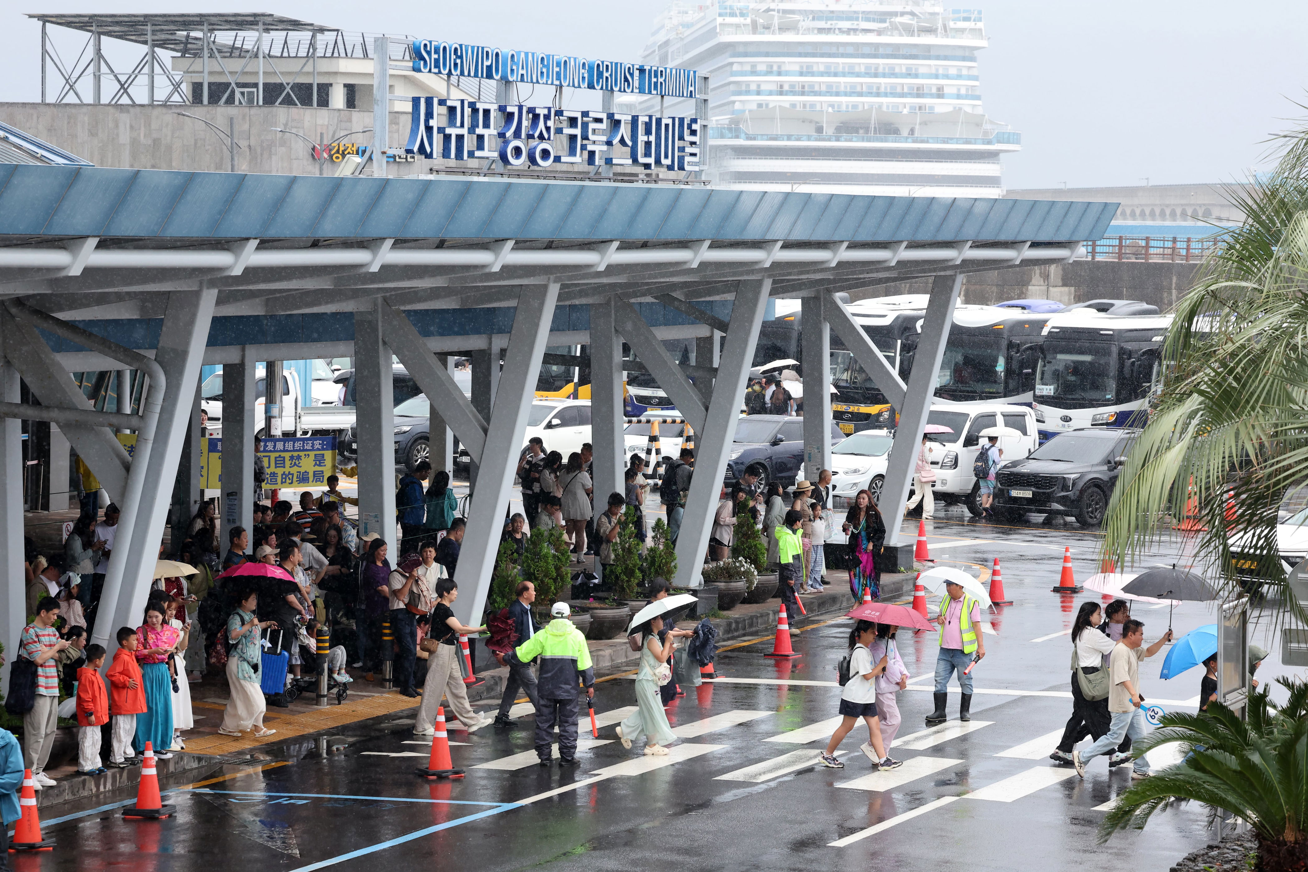
As of 9 a.m. on the day, Jeju Island has a strong wind advisory in effect across the entire region. A high wave advisory has also been issued for the waters around Jeju Island, and Jeju International Airport recorded an instantaneous wind speed of 21.4 m/s.
A KMA official urged, “As strong winds may cause disruptions to aircraft operations, airport users are requested to check flight information in advance.”
At sea, areas centered around the South Sea and East Sea will experience sudden gusts of wind accompanied by thunderstorms. Waves in the East Sea are expected to reach 1.0–5.0 m, 0.5–3.0 m in the West Sea, and 1.0–3.0 m in the South Sea. In the outer seas, wave heights are forecasted to be 1.0–5.5 m in the East Sea, 1.0–3.5 m in the West Sea, and 1.5–3.5 m in the South Sea.
In the East Sea, waves may reach up to over 5 m until the 21st, so vessels navigating or fishing should check the latest weather information. Daytime high temperatures are expected to range from 22 to 30 degrees Celsius, similar to the annual average.
- Author: Tyo Murty


At the moment there is no comment