
First Alert: Dangerous Heat and Severe Storms This Sunday

info Adjust the font size of this article to get the best reading experience.
Dangerous Weather Conditions Expected in Central Wisconsin
Where and When
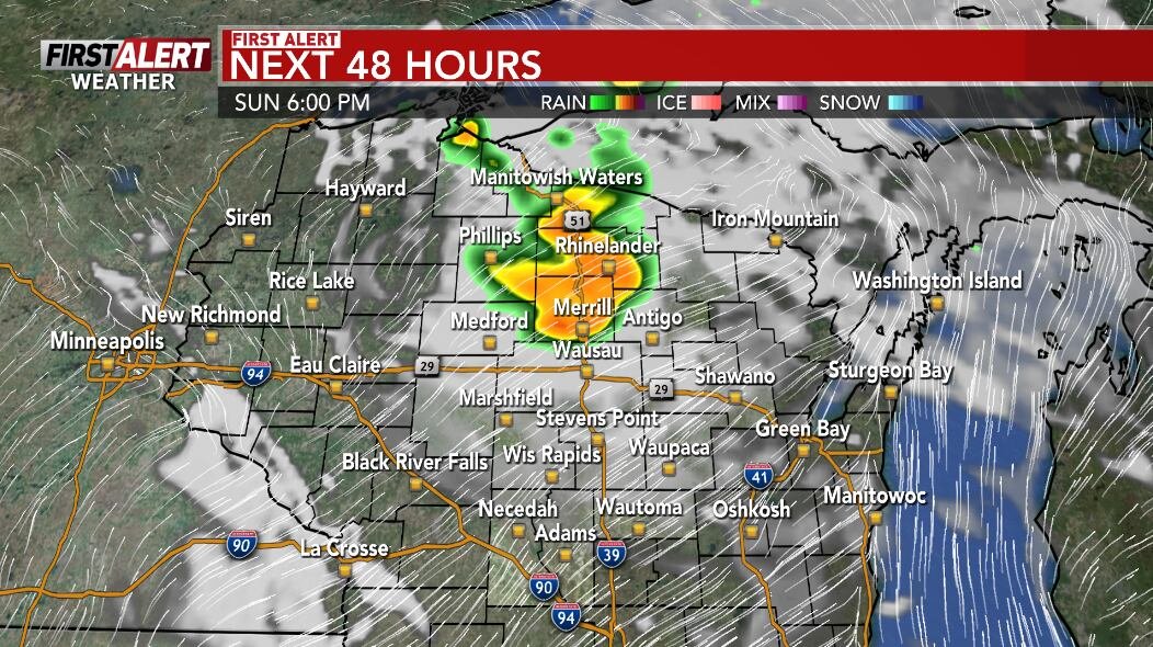
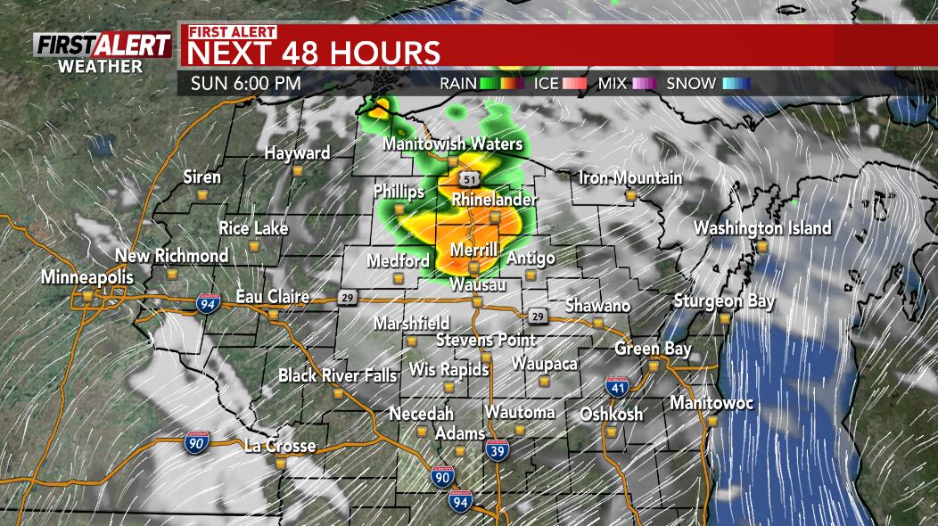
The entire area of central Wisconsin is under a weather alert for Sunday afternoon and evening. The day will be marked by dangerous heat during the afternoon, followed by the possibility of strong to severe storms as the sun sets.
Threats to Be Aware Of
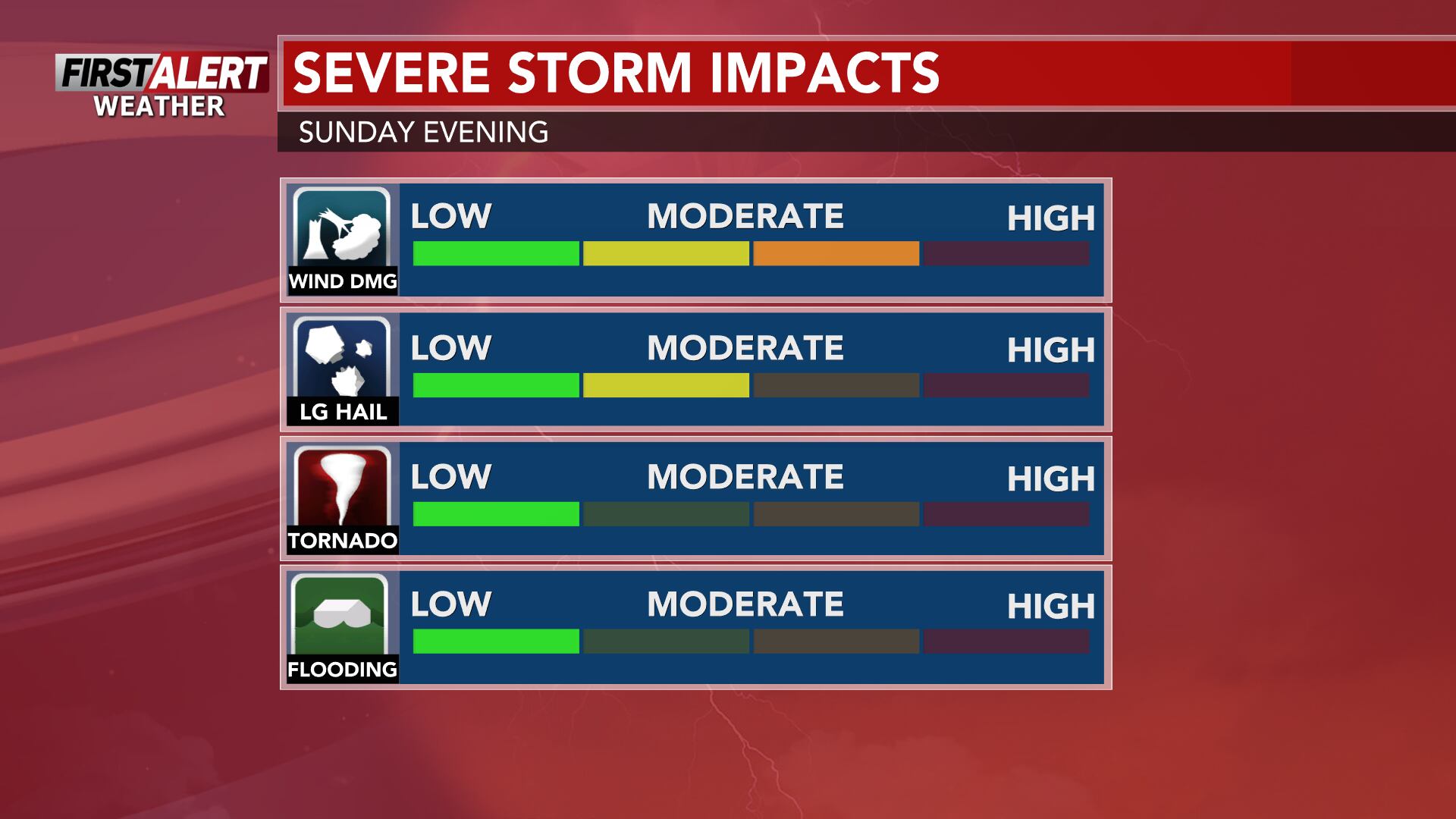
The main threats associated with this weather event include strong to severe storms that could bring damaging wind gusts, large hail, and heavy downpours. It’s important to stay informed and prepared for these potential hazards.
Weekend Weather Outlook
Sunday: Hot, Humid, and Stormy
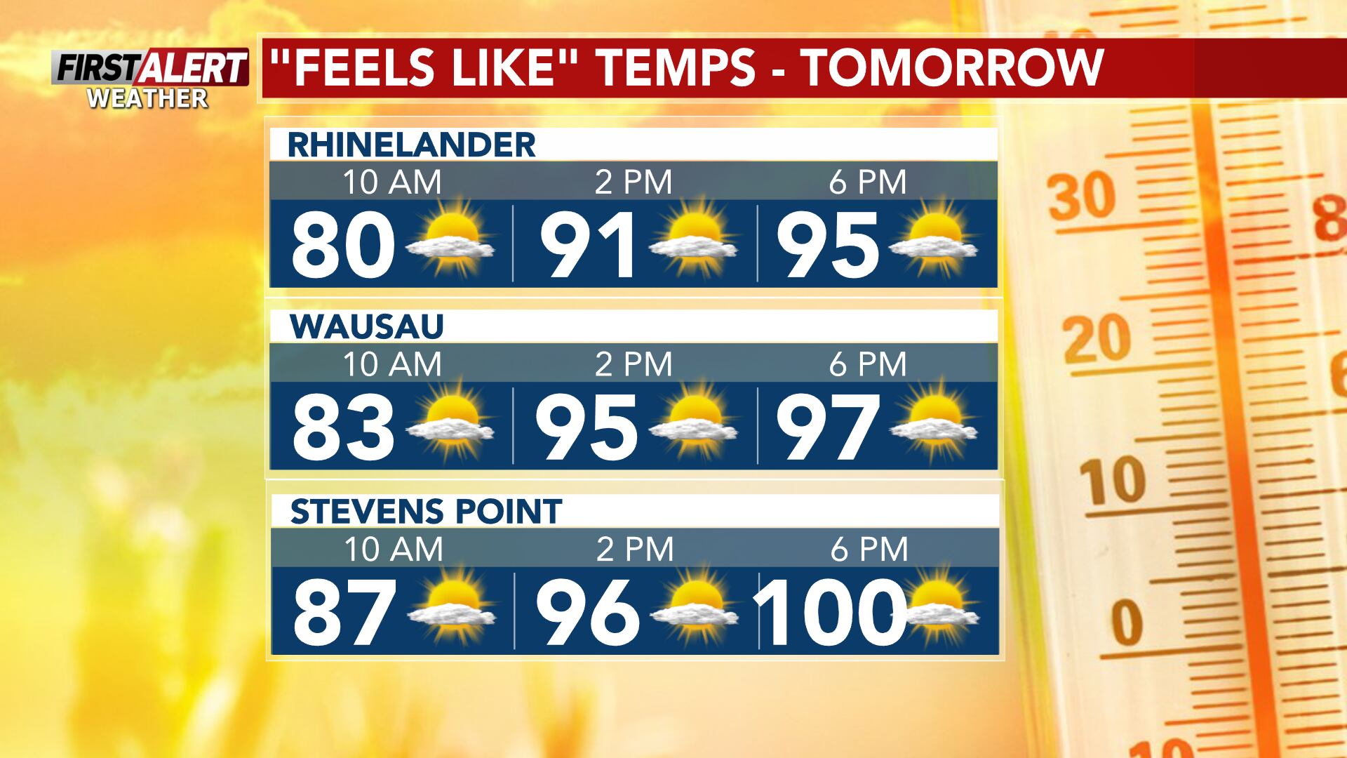
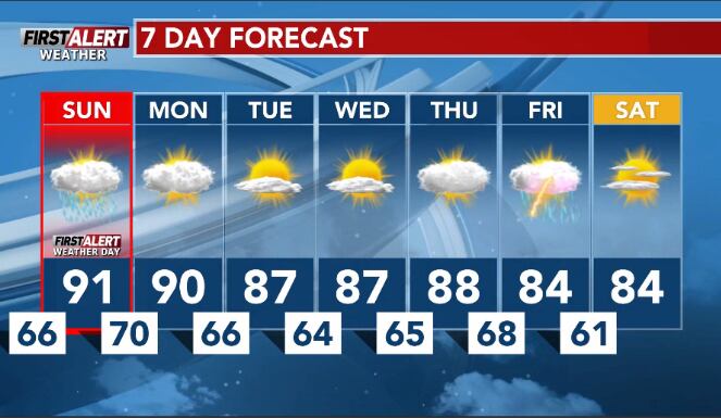
Sunday will start with partly cloudy skies and very hot and humid conditions. There is a risk of scattered storms developing during the afternoon and evening. Temperatures are expected to rise into the low 90s, with afternoon heat index values reaching as high as the mid-90s to around 100 degrees.
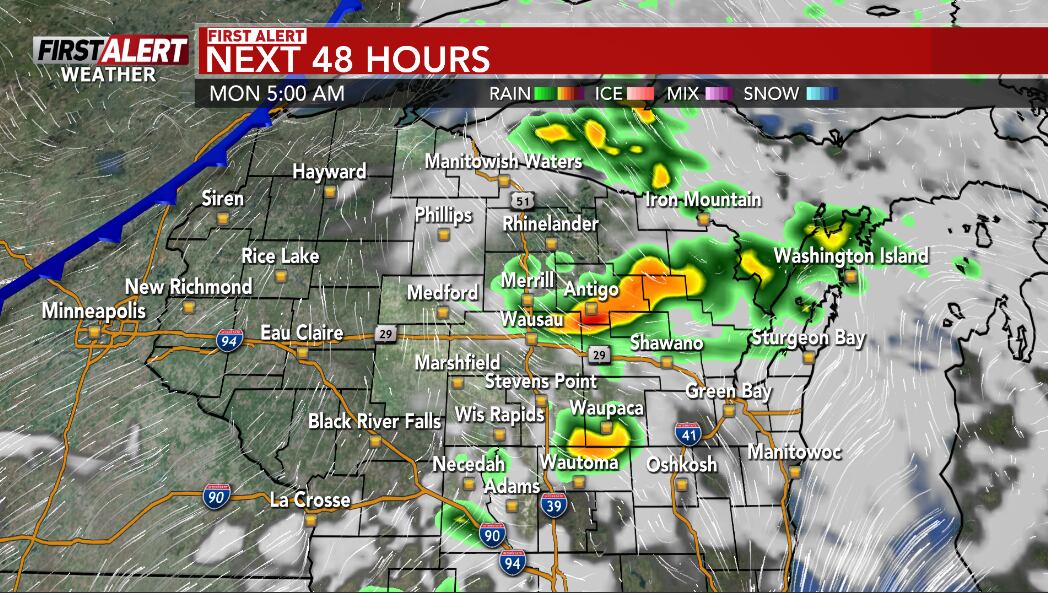
In addition to the heat, there is a chance that storms may develop in the afternoon and evening. If they do, they could become severe, bringing damaging winds, large hail, and heavy rain. However, it’s also possible that no storms will form at all due to a cap or lid on the atmosphere from warm air aloft. This situation will be closely monitored throughout the day and into the evening.
Monday: Continued Heat and Possible Storms
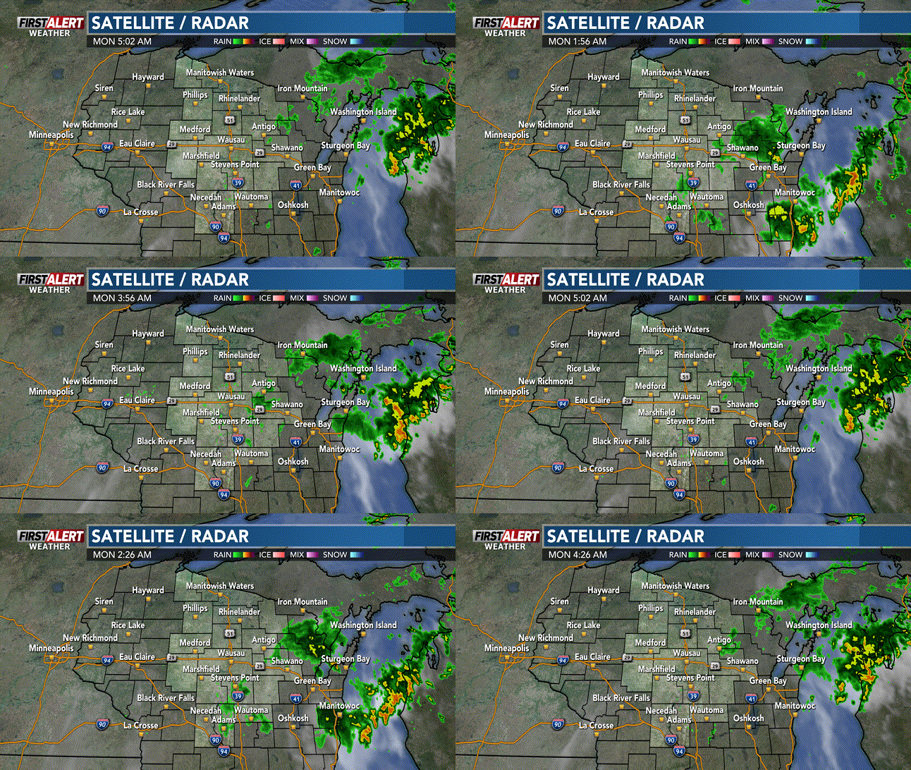
Monday will remain hot and humid, with a chance of storms developing in the afternoon as a cold front approaches the region. These storms have the potential to be strong, so it’s important to keep an eye on the forecast. High temperatures are expected to stay in the low 90s, with afternoon heat index values ranging from the low to mid 90s.
Week Ahead Forecast
Tuesday and Wednesday: Warm and Less Humid
Tuesday and Wednesday will see warmer temperatures but with less humidity. There will be a fair amount of sunshine, and highs are expected to be in the mid-80s.
Thursday: Sunny and Warm
Thursday will be another warm day with more sunshine than clouds. Highs are projected to be in the mid to upper 80s.
Friday: Cloudy with Showers and Storms
Friday will bring cloudy skies and the possibility of scattered showers and storms. High temperatures will be in the low to mid 80s.
Saturday: Partly Cloudy and Mild
Saturday will be partly cloudy with highs in the mid-80s. The weather will be more moderate compared to the previous days.
First Alert Weather Forecast for Central Wisconsin
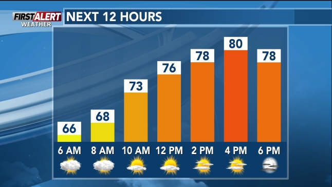
Next 12 Hours
Here’s a look at the First Alert Weather Forecast for central Wisconsin over the next 12 hours. As always, it’s recommended to check back for the latest updates and changes to the forecast.
Stay Informed
For the most up-to-date information, consider downloading the WSAW News app or the WSAW First Alert weather app. You can also submit your weather photos to help provide real-time updates on local conditions.
- Author: Tyo Murty




















At the moment there is no comment